
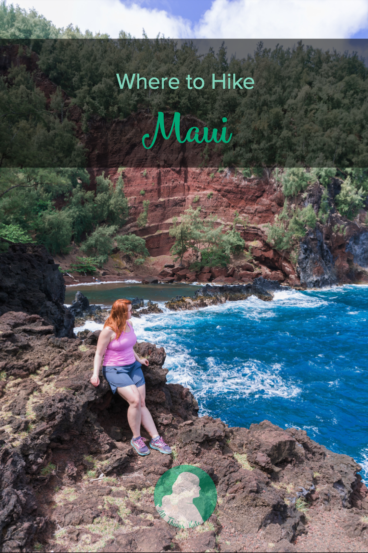
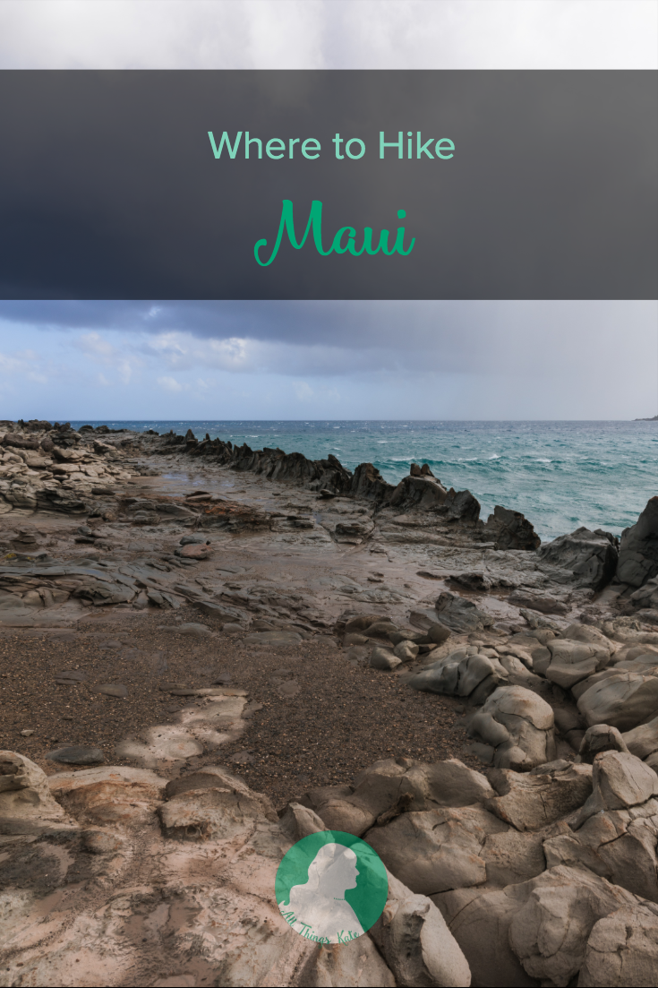
Where to Hike: Maui
West Maui
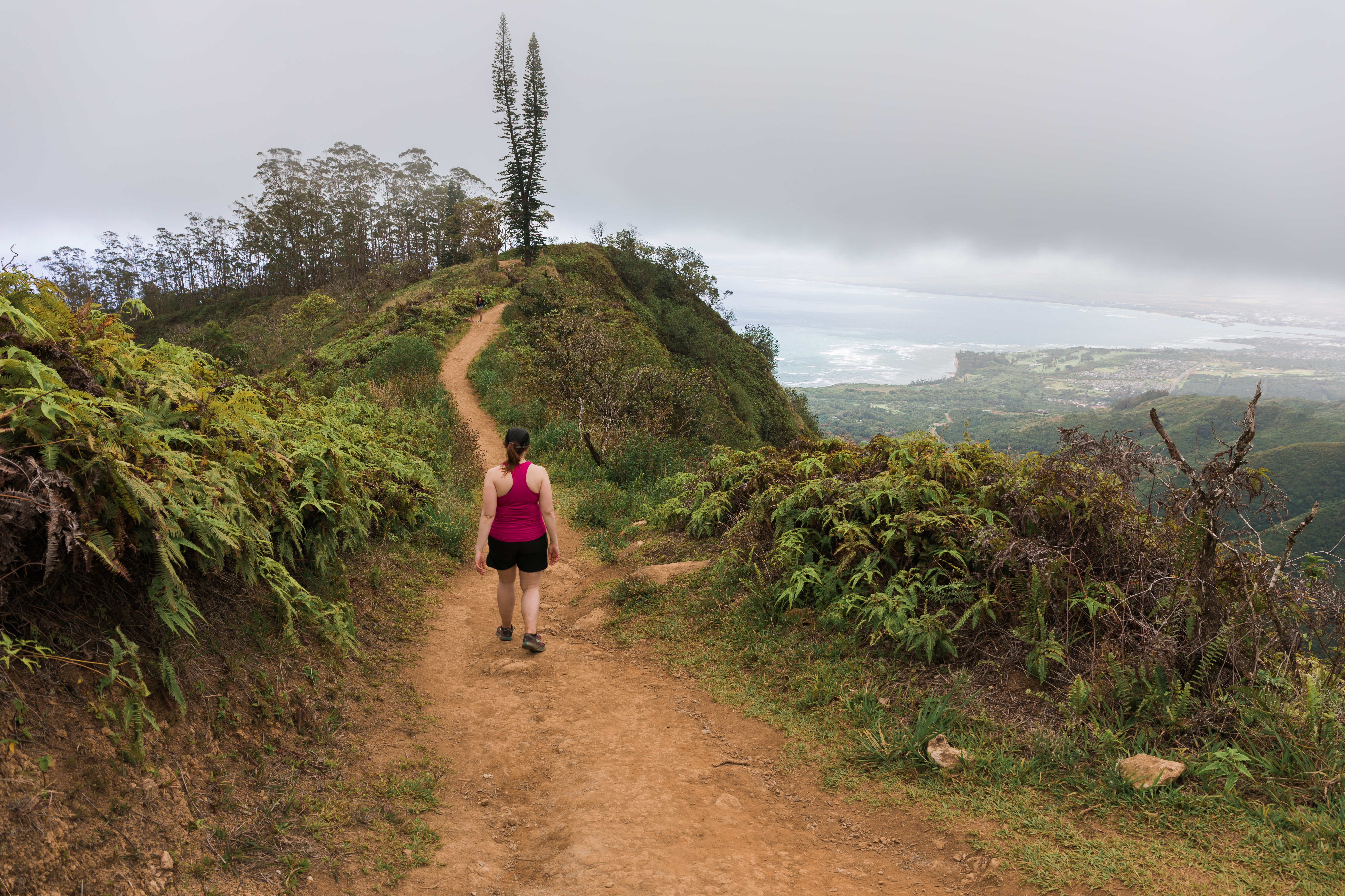
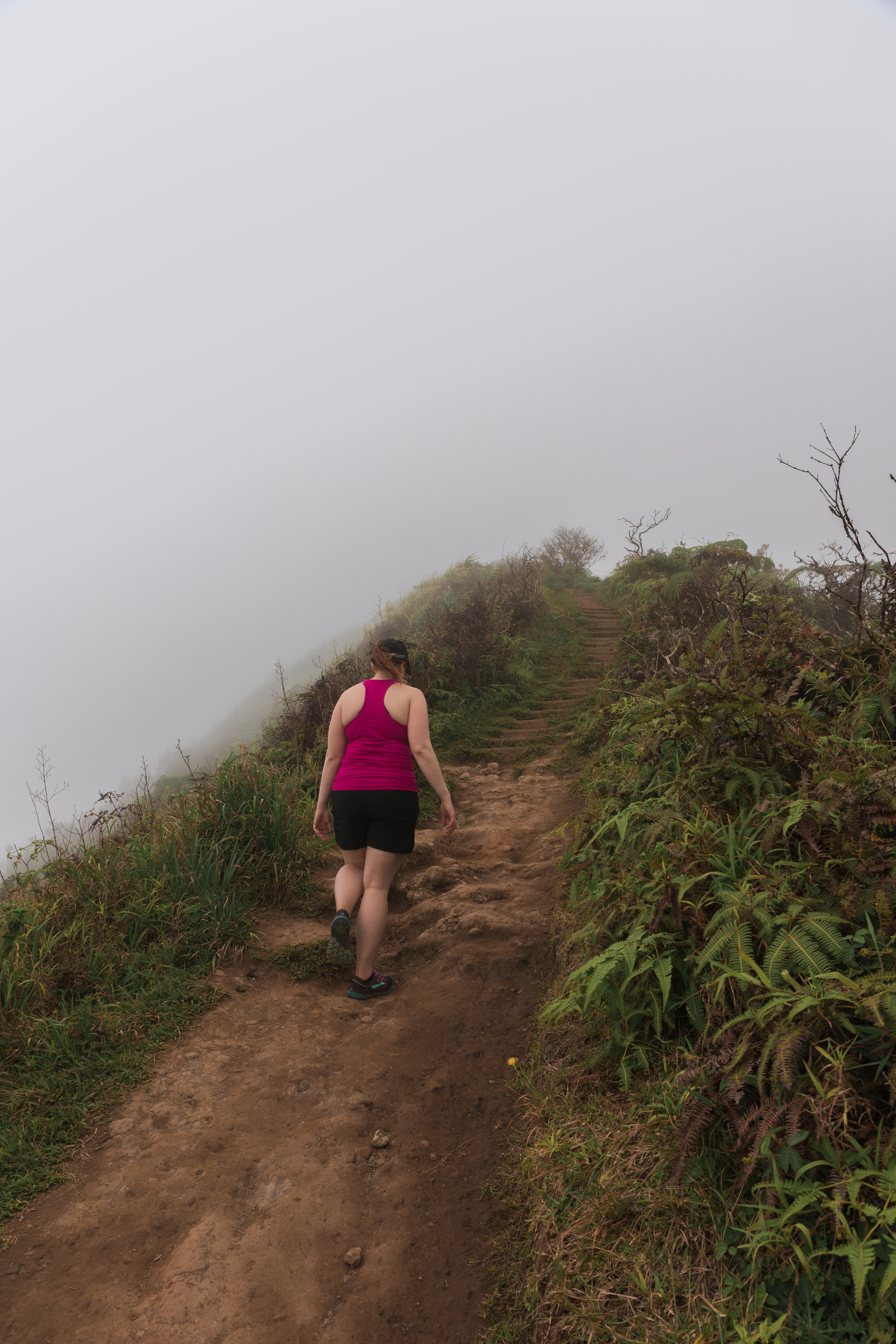
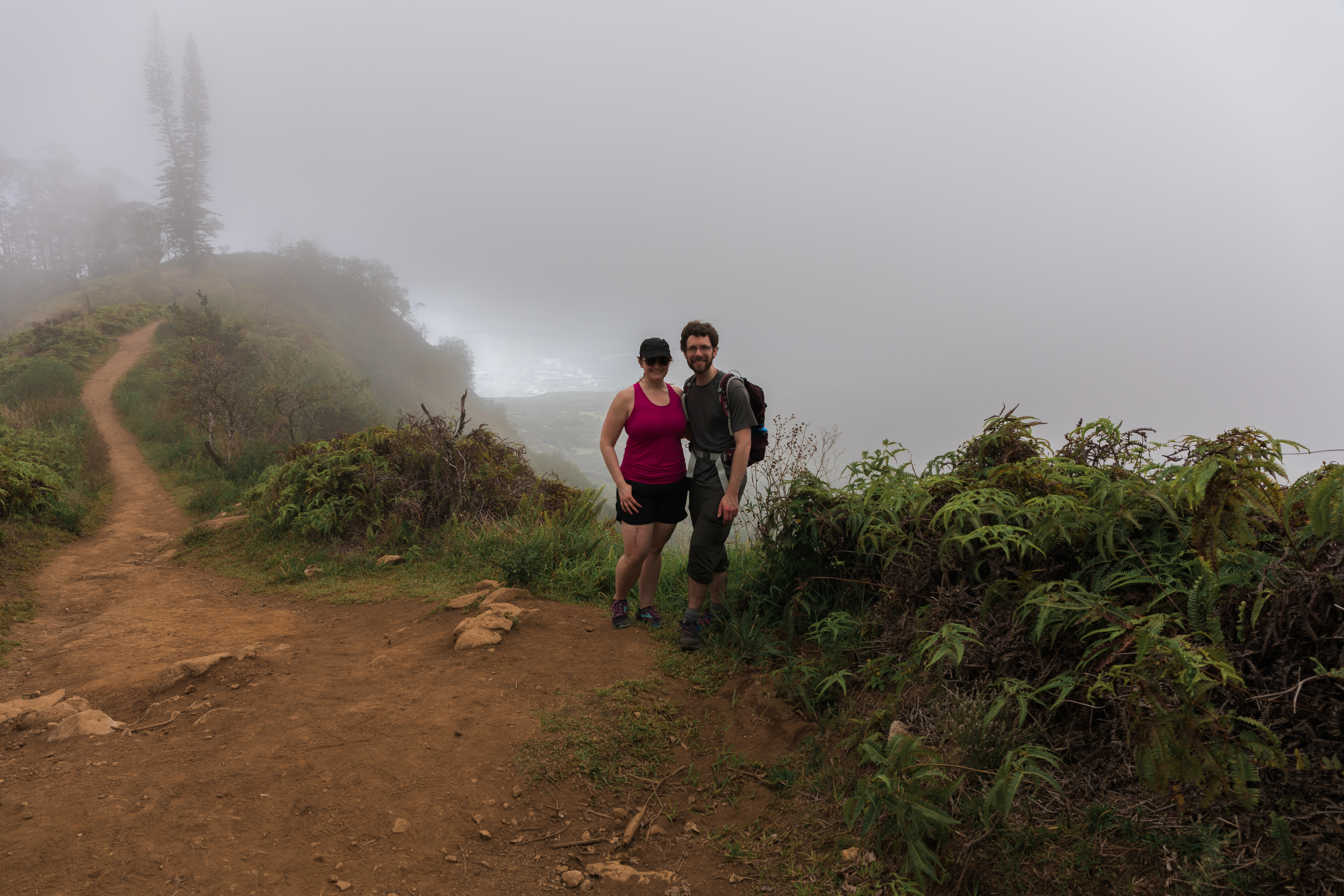
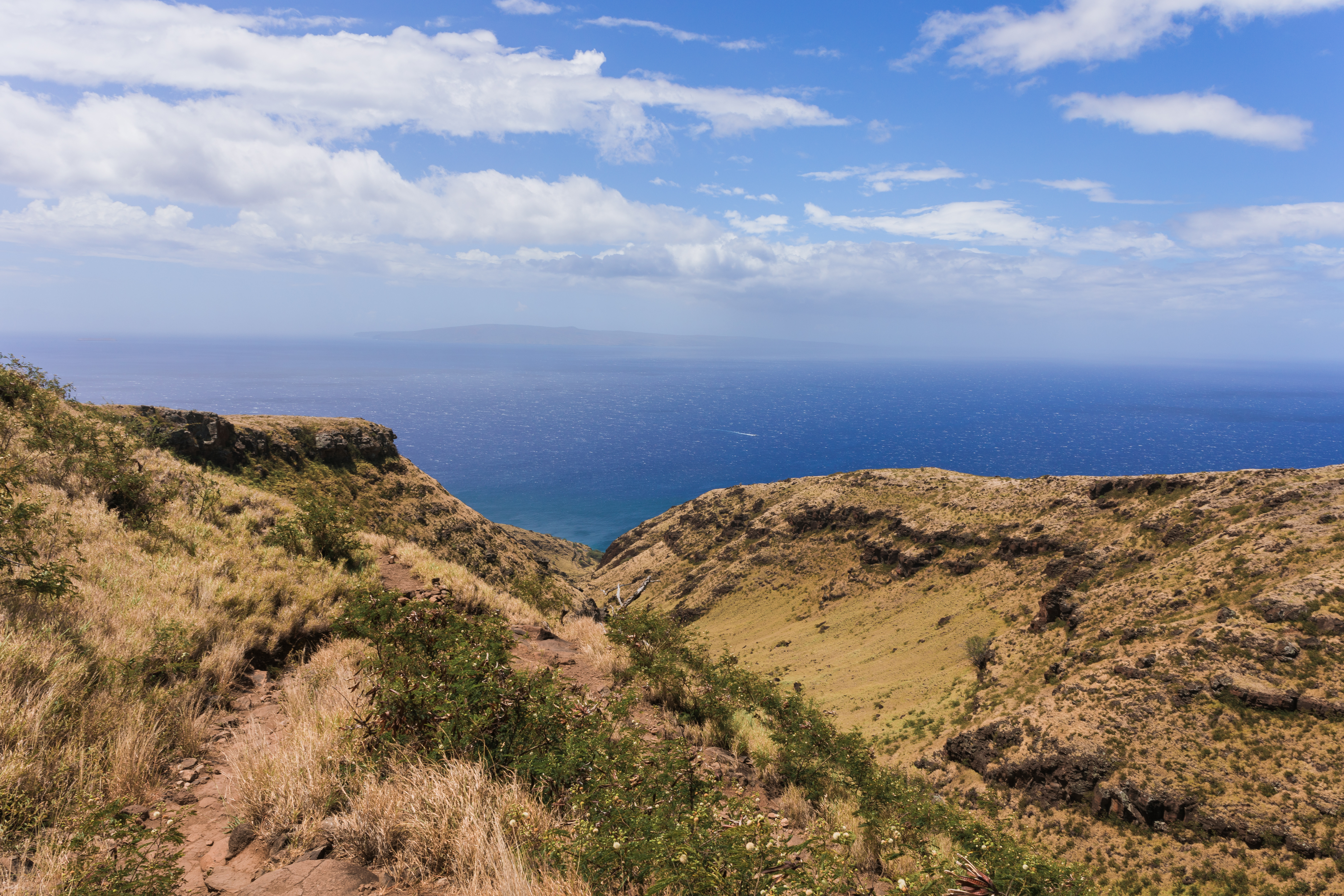
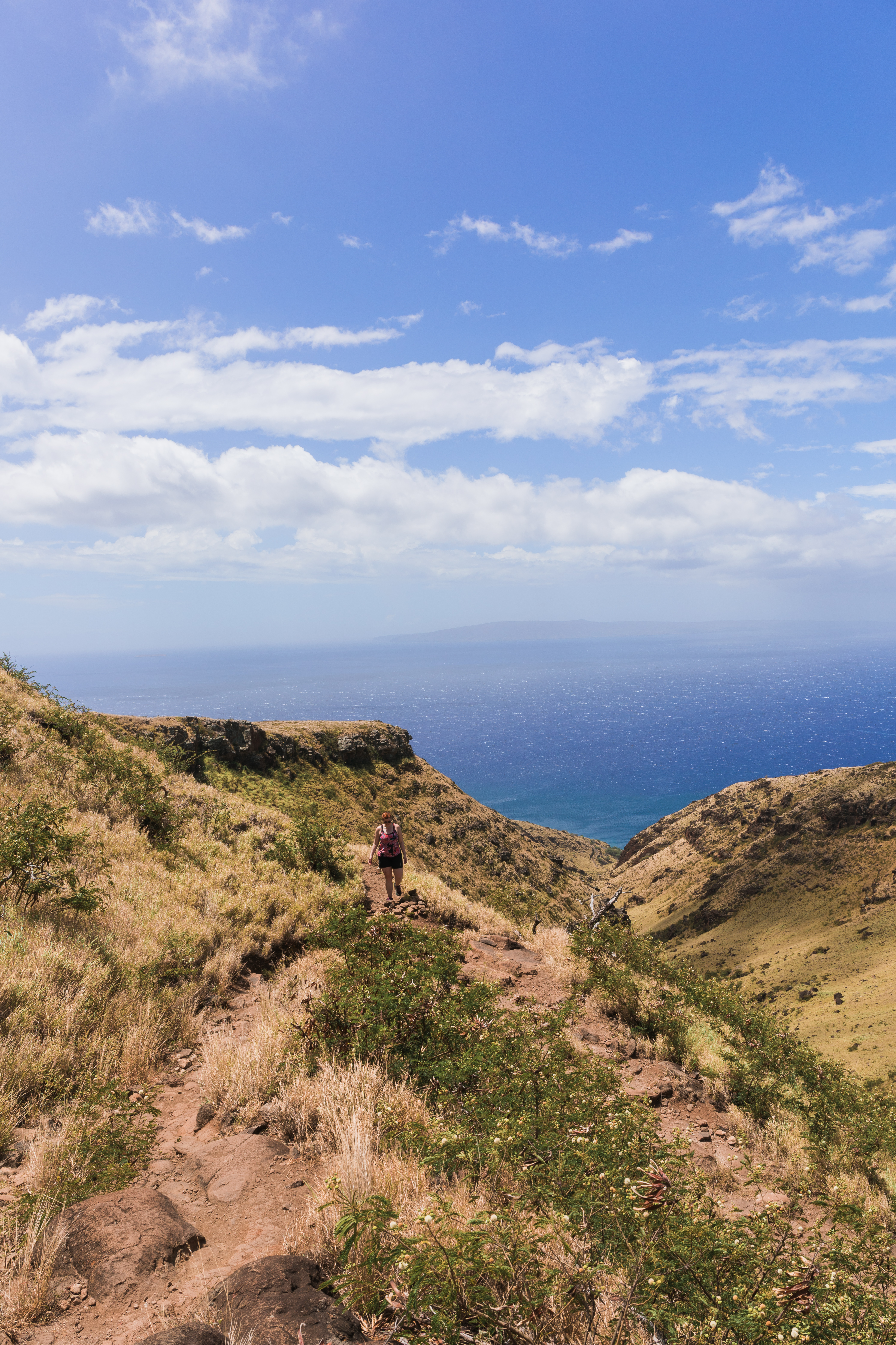
Waihe’e Ridge Trail
We’ve heard this is a very nice trail with lots of good views. Unfortunately, the day we did it, nearly the entire trail was socked in with fog. As another hiker said, the pictures we got will make great additions to our collection of photos of Hawaiian fog. The hike itself wasn’t too busy, though there were a good number of people on it. It is a ridge trail, which means lots of uphill hiking with steep dropoffs, though none nearly as scary as the Moanalua Middle Ridge Trail on Oahu. Be sure to get there early though, as the first parking lot fills up early and the overflow parking lot is quite a ways further down the hill.
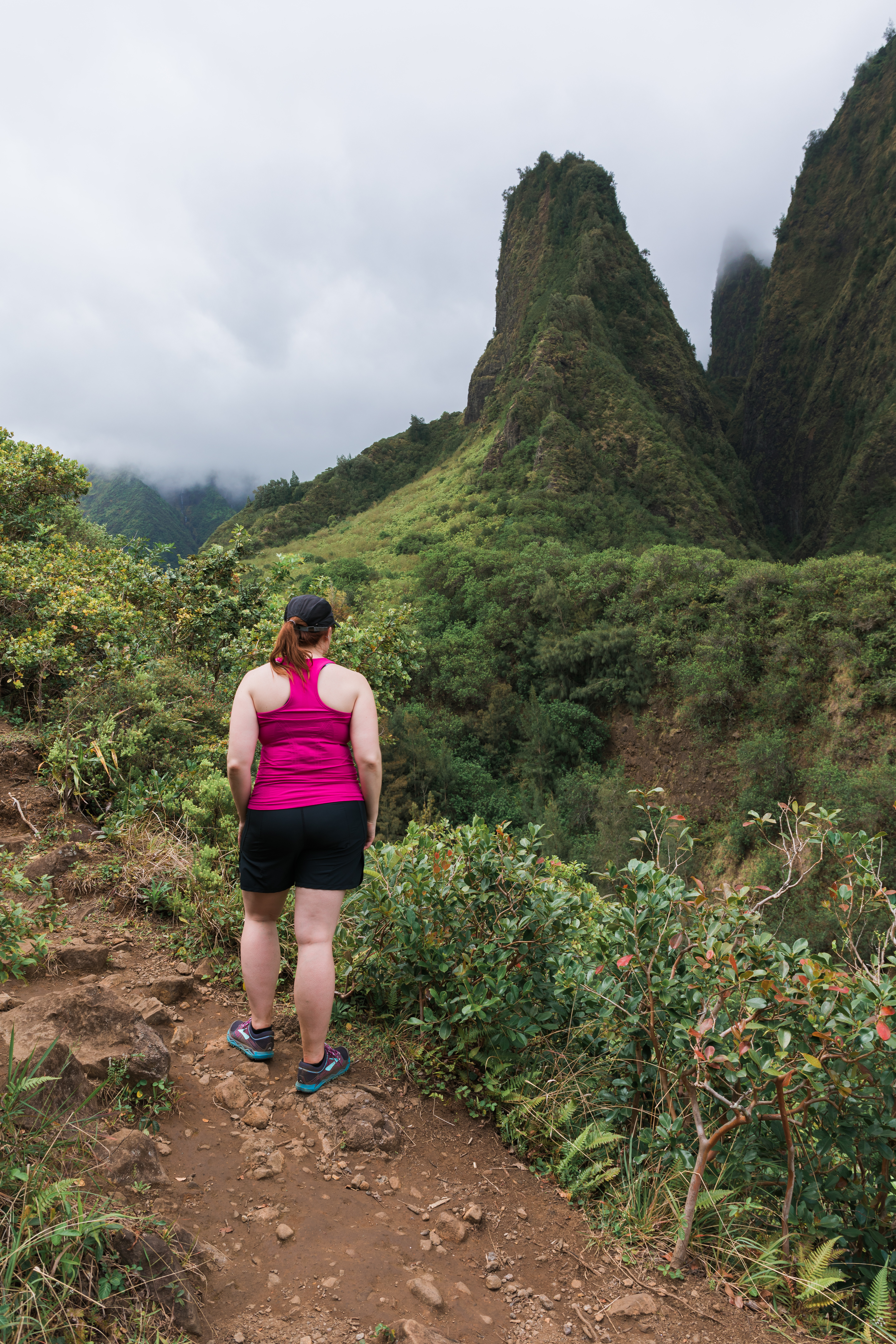
 Iao Valley State Park
Not far from the Waihe’e Ridge trailhead is the Iao Valley State Park and both can easily be done in the same day. The state park is a nice, short walk through some beautiful gardens and landscapes. You can find reports of an “illegal” hike past the uppermost lookout, to get a slightly better view.
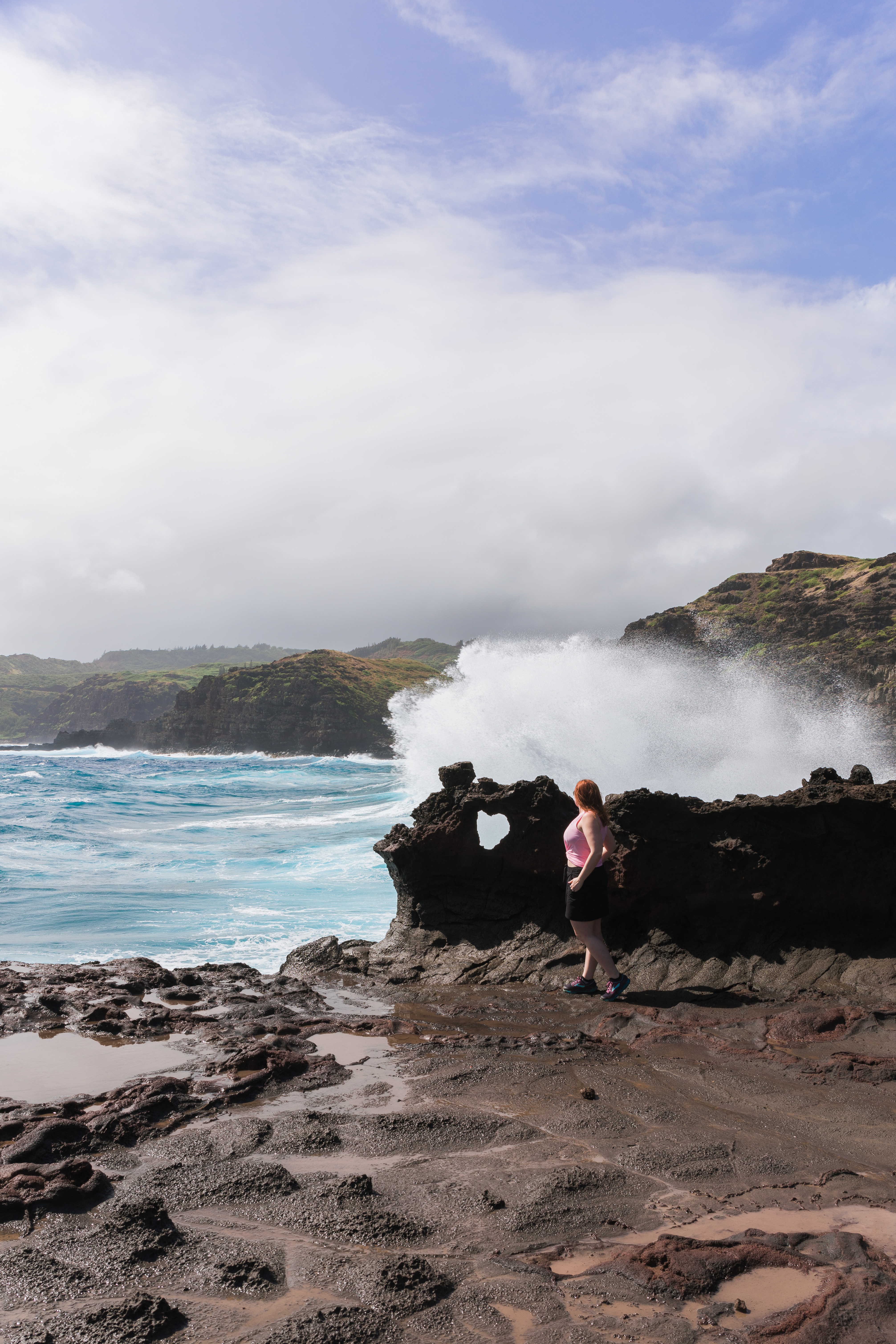
Nakalele Blowhole & Sweetheart Rock
Many people say the Kahekili Highway (aka Death Highway) is scarier than the road to Hana. We honestly didn’t find it all that bad, and along the way we found a few decent places to stop, including the Nakalele Blowhole. It’s not a long hike to get to the blow hole, just follow the crowds or the site of the blow hole itself – you can see it while you are still standing only a little ways from the parking lot. Once you make it down to the blow hole, turn around and look for the heart shaped rock. From the pictures online, we were expecting something 10 or 20 feet tall way out in the distance, but it turned out to be a lot smaller and a whole lot more accessible.
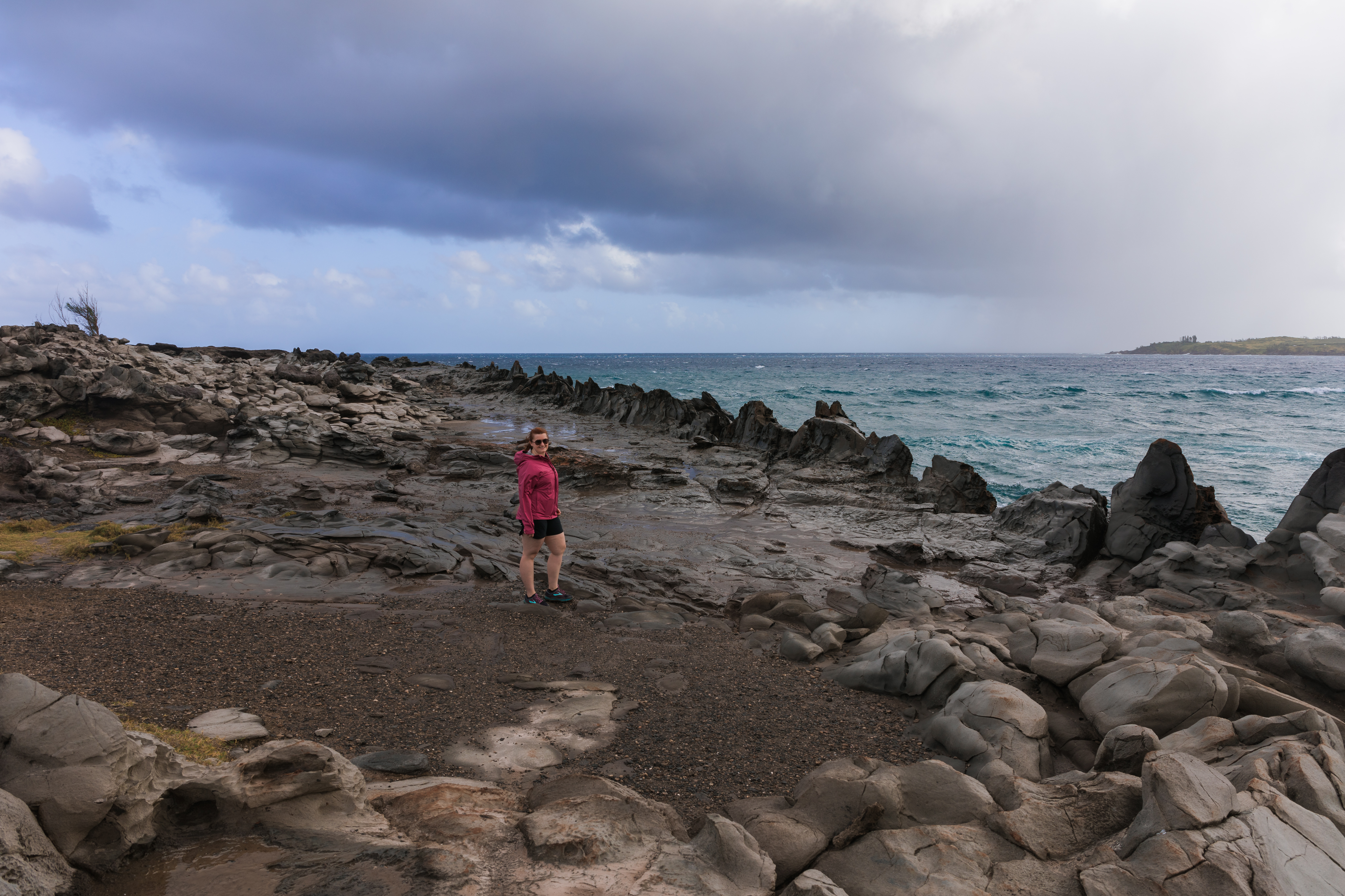
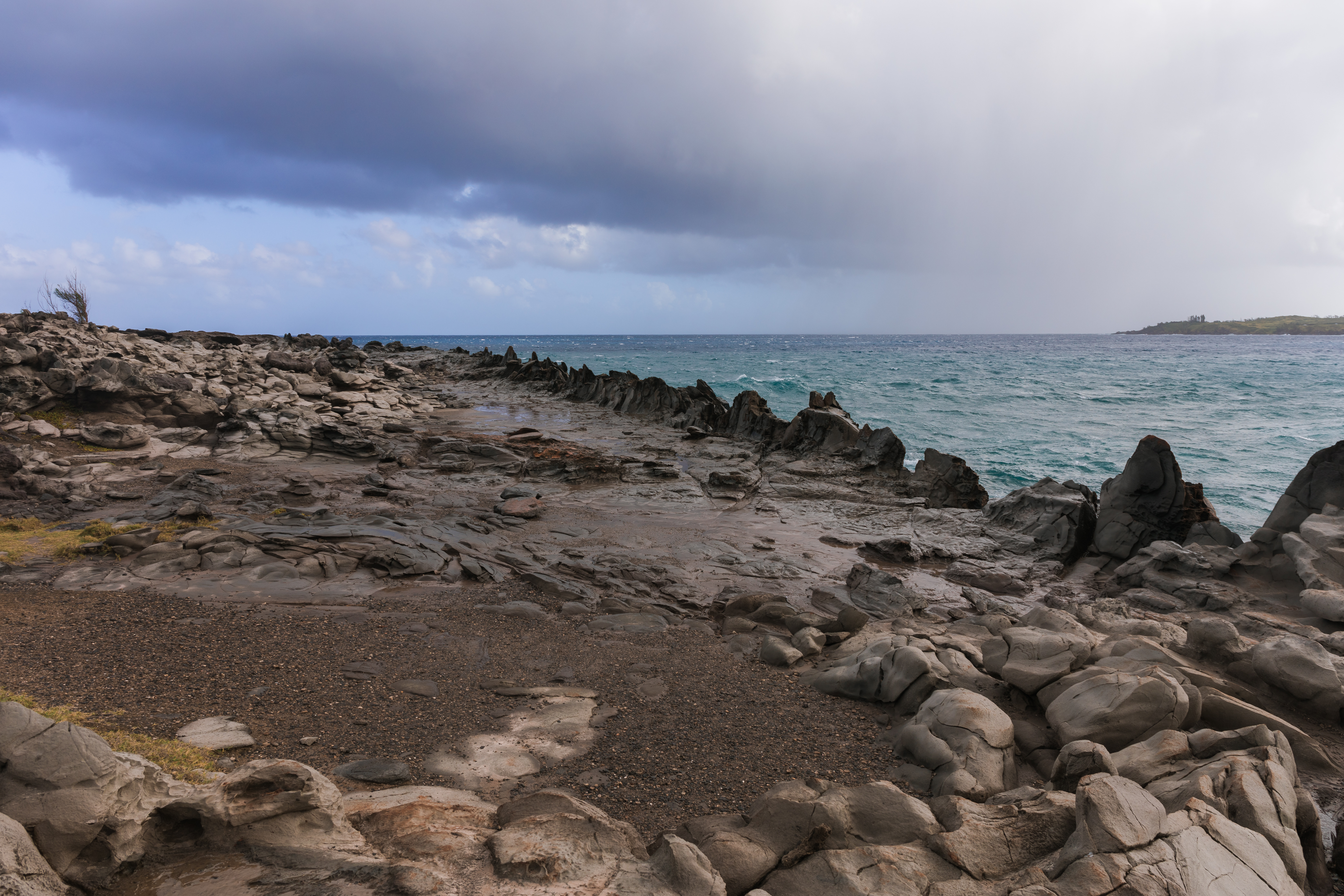
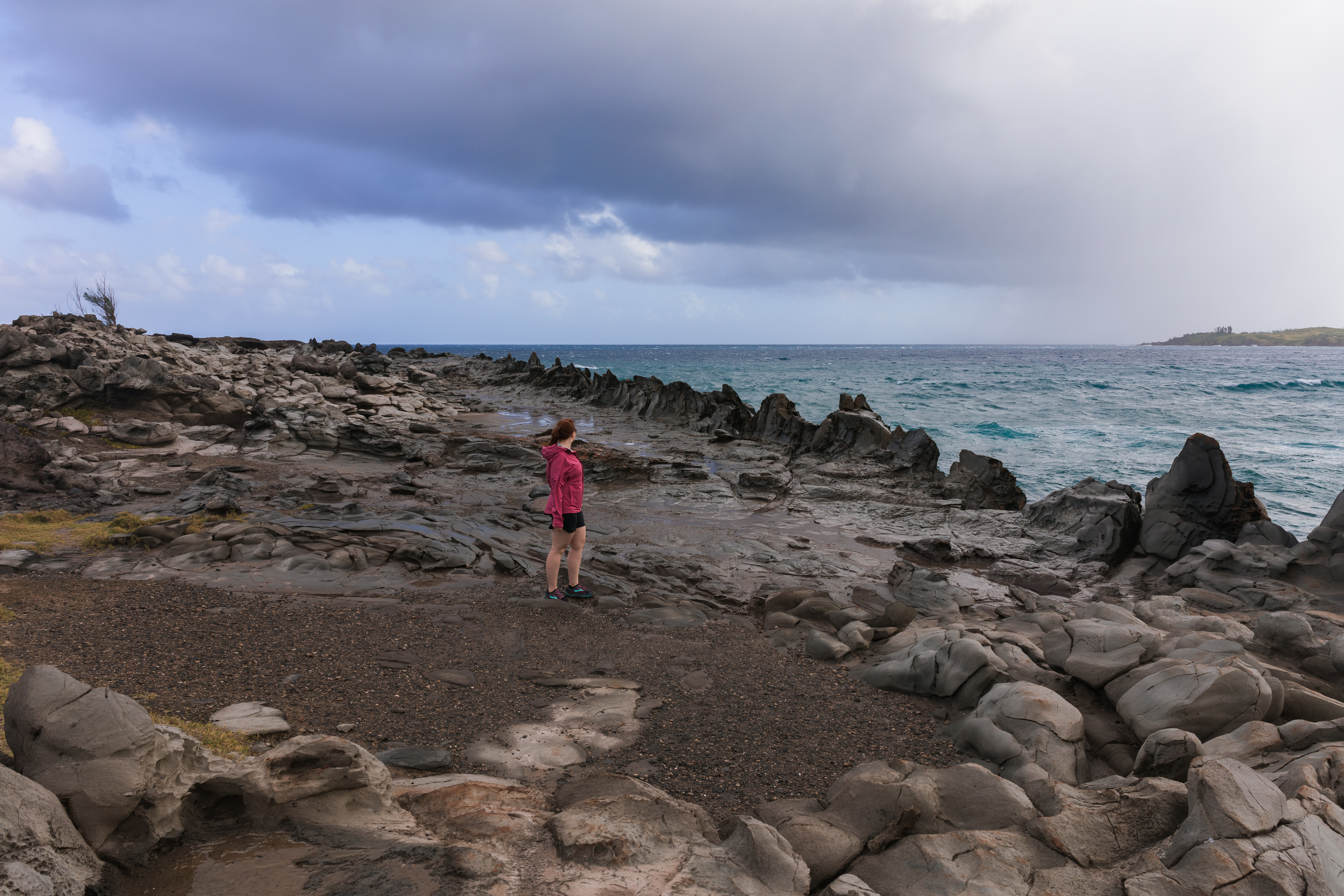
Dragon’s Teeth
While it feels like you may be parking at the golf course and then that you are walking on the golf course, trust me, you aren’t. From the parking lot, head directly west towards the water. You’ll pass the trash can and then shortly see a roped off trail. It’s a short walk from there down to the rocky coast line and to the “Dragon’s Teeth”.
Lahaina Pali Trail
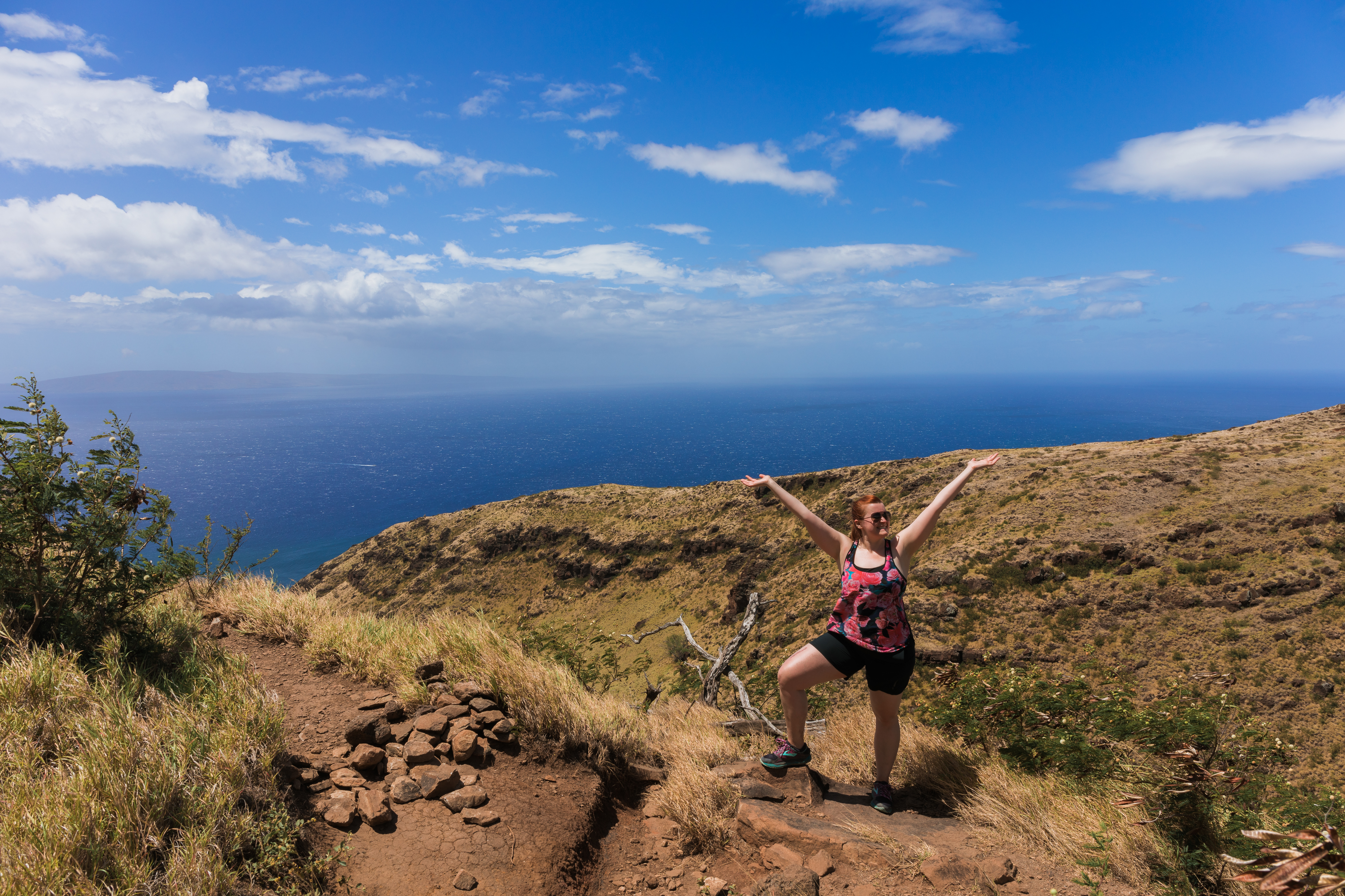
This isn’t the most exciting hike on the island, but if you’re staying in Lahaina or Kihei, it’s very easy to get to. It’s five miles from one side to the other and the halfway point are the wind turbines you can see from far away. We started from the parking lot on the Lahaina side and made it to the turbines before turning around, enjoying beautiful views of the ocean along the way. The other side provides gorgeous views of the island and of Haleakala. Just a warning though, there’s a reason they put the wind turbines on the ridge!
Road to Hana / East Maui
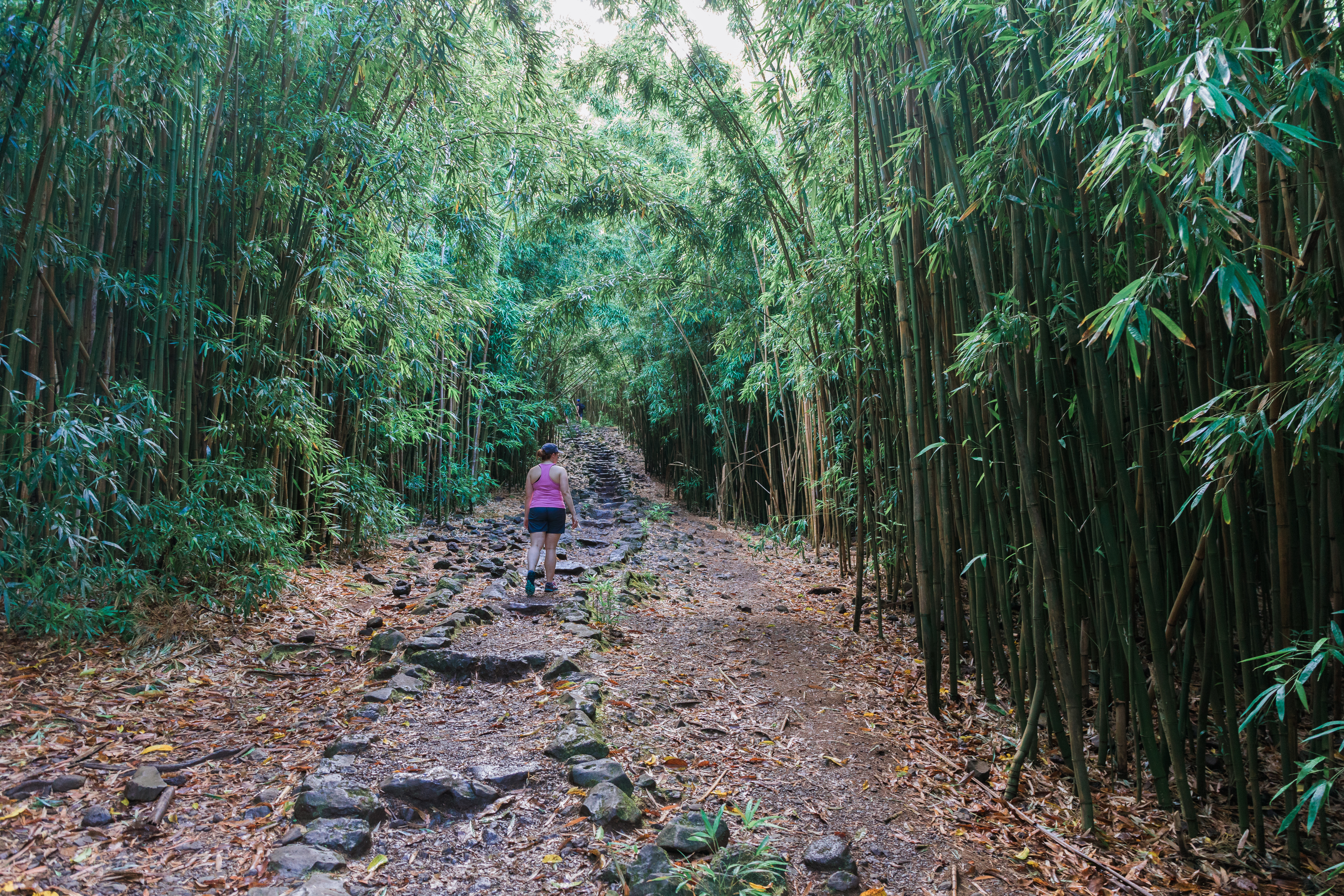
Bamboo Forest (Na’ili’ili Haele)
This is one of the first hikes on the Road to Hana. It’ll be hard to miss too, as you’ll see a bunch of bamboo growing on the side of the road with lots of cars parked all over. Pull over and look for a hole in the bamboo. Follow it back until you find the main stream (not the little one that you hop across). Hike upstream until you get tired of finding waterfalls. Supposedly there are as many as five of them as you hike upstream, though they also get progressively harder to reach. If you don’t reach them all, that’s okay. You’ll find many more waterfalls on the Road to Hana.
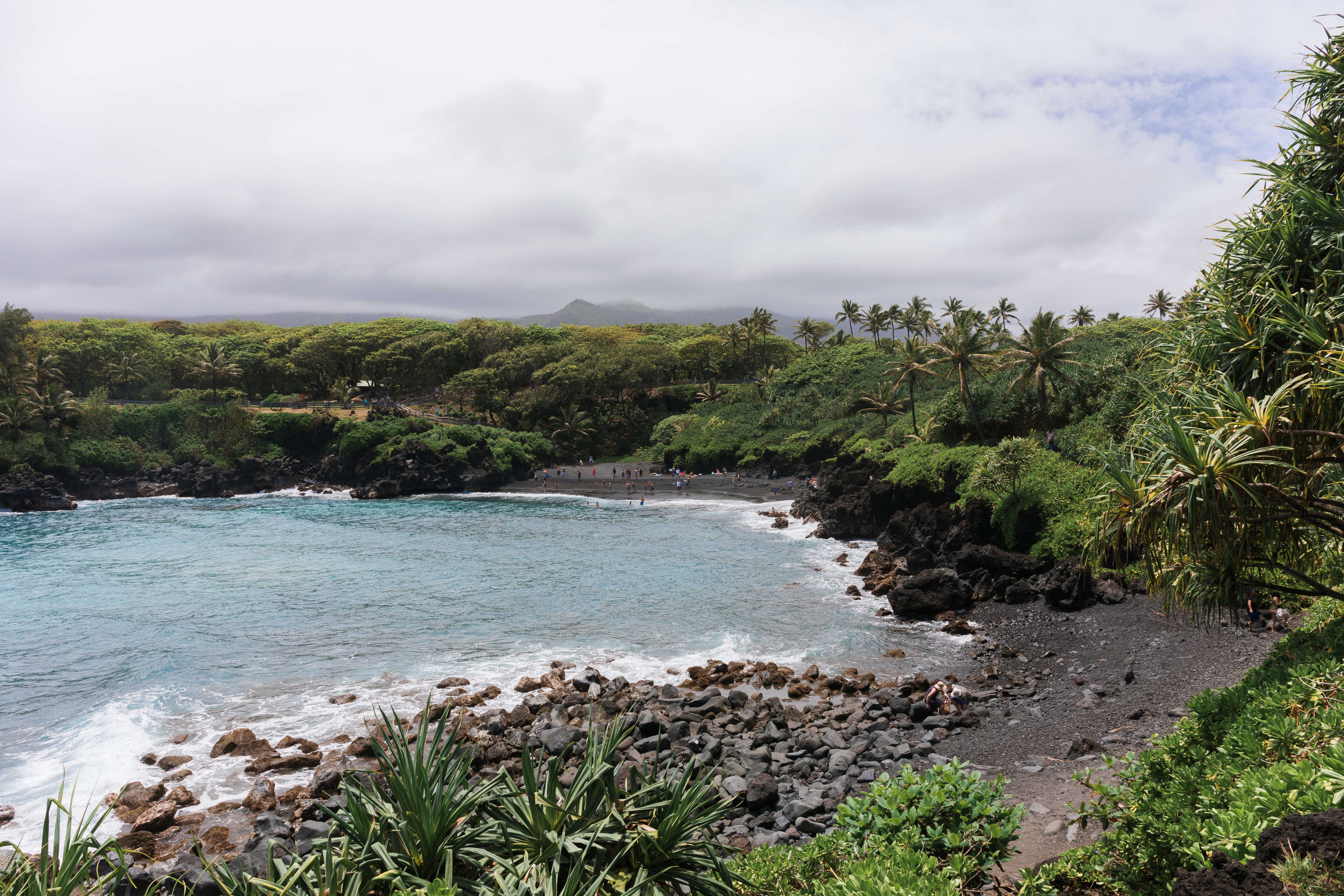
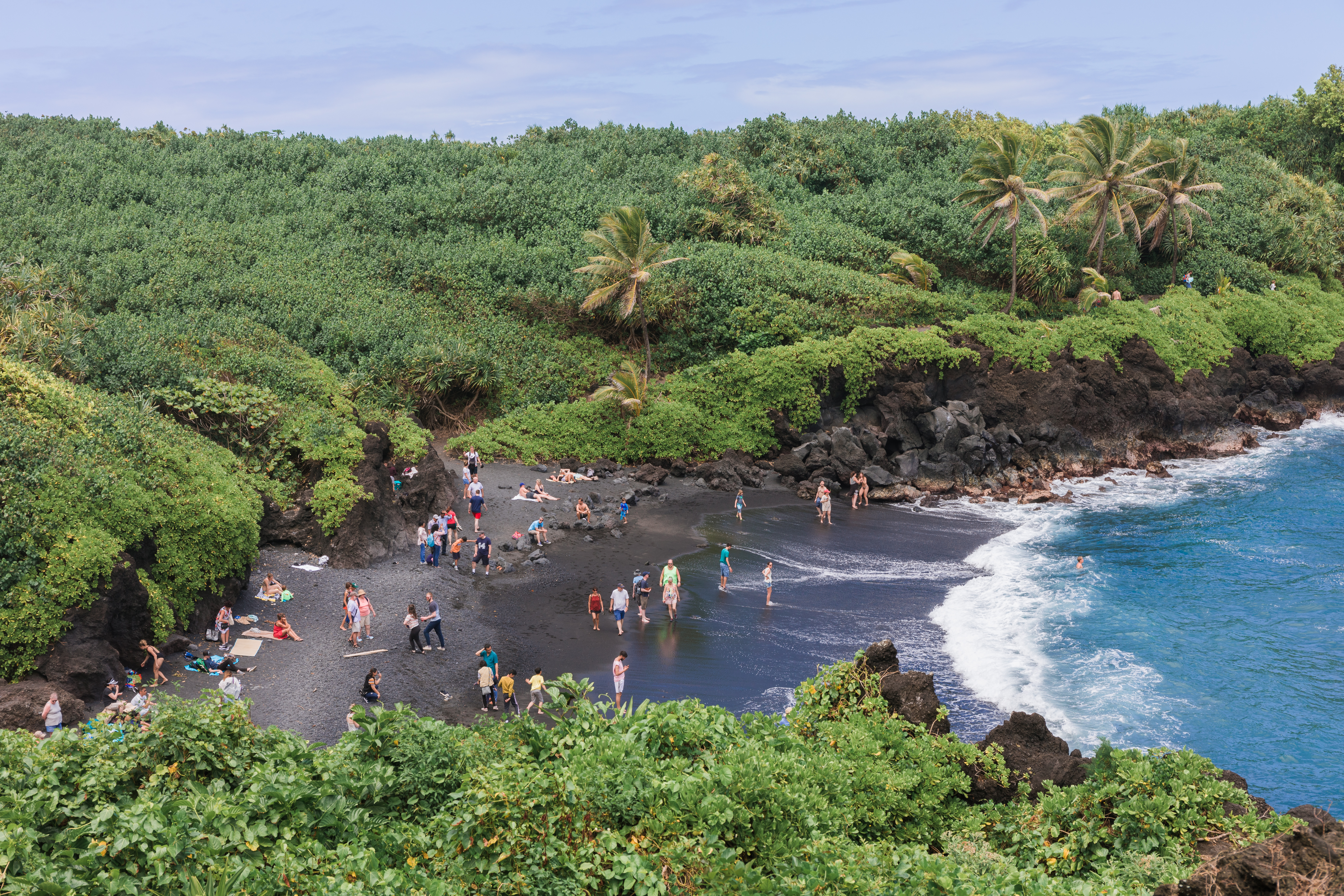
Black Sand Beach & Blowhole
It’s not much of a hike to reach the black sand beach, just down a few steps from the parking lot. But once you’ve had enough time on the sand, proceed to the far side of the beach and head up the trail across the lava rock. It’s a pretty easy hike, but keep your eye out for a short blowhole.
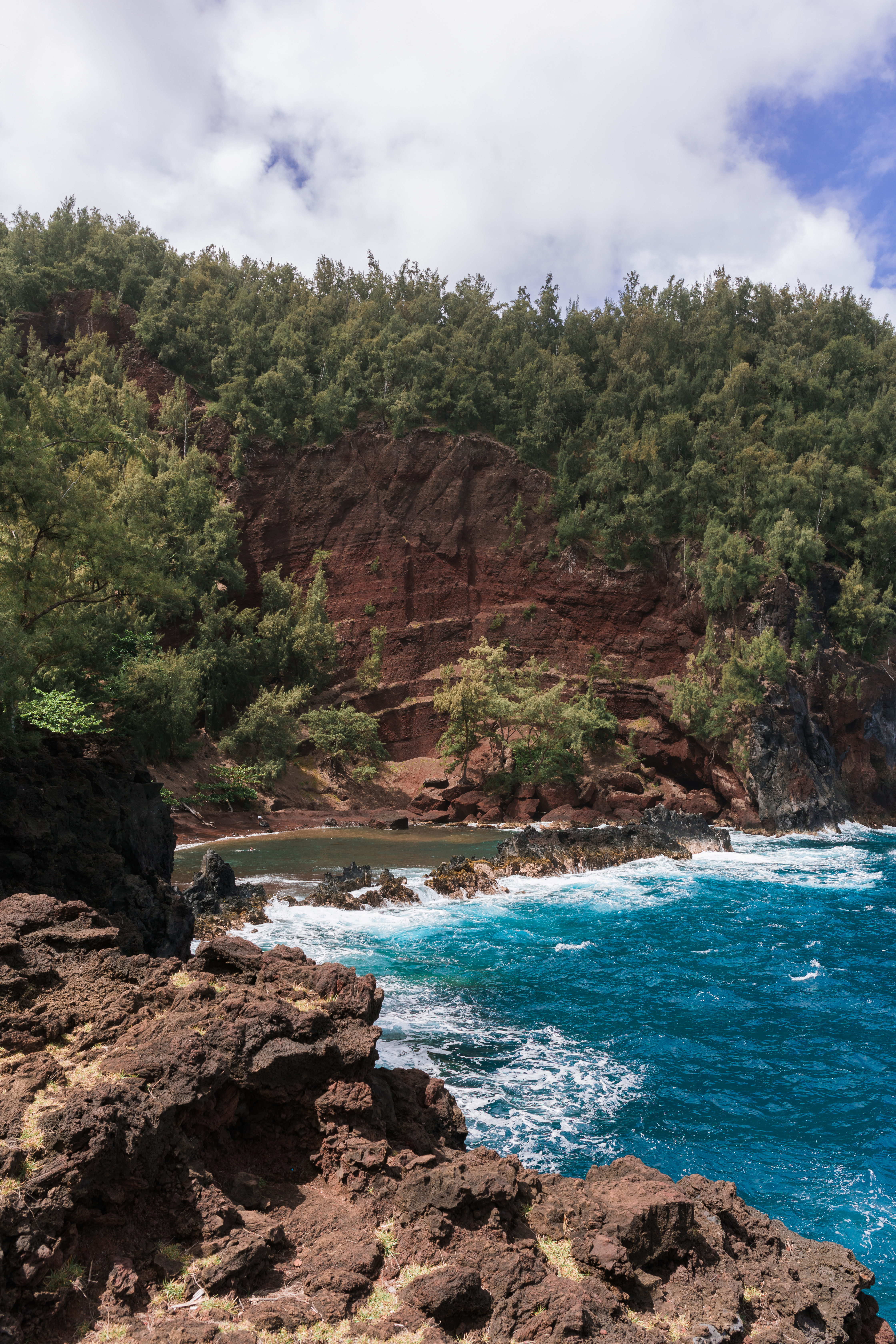
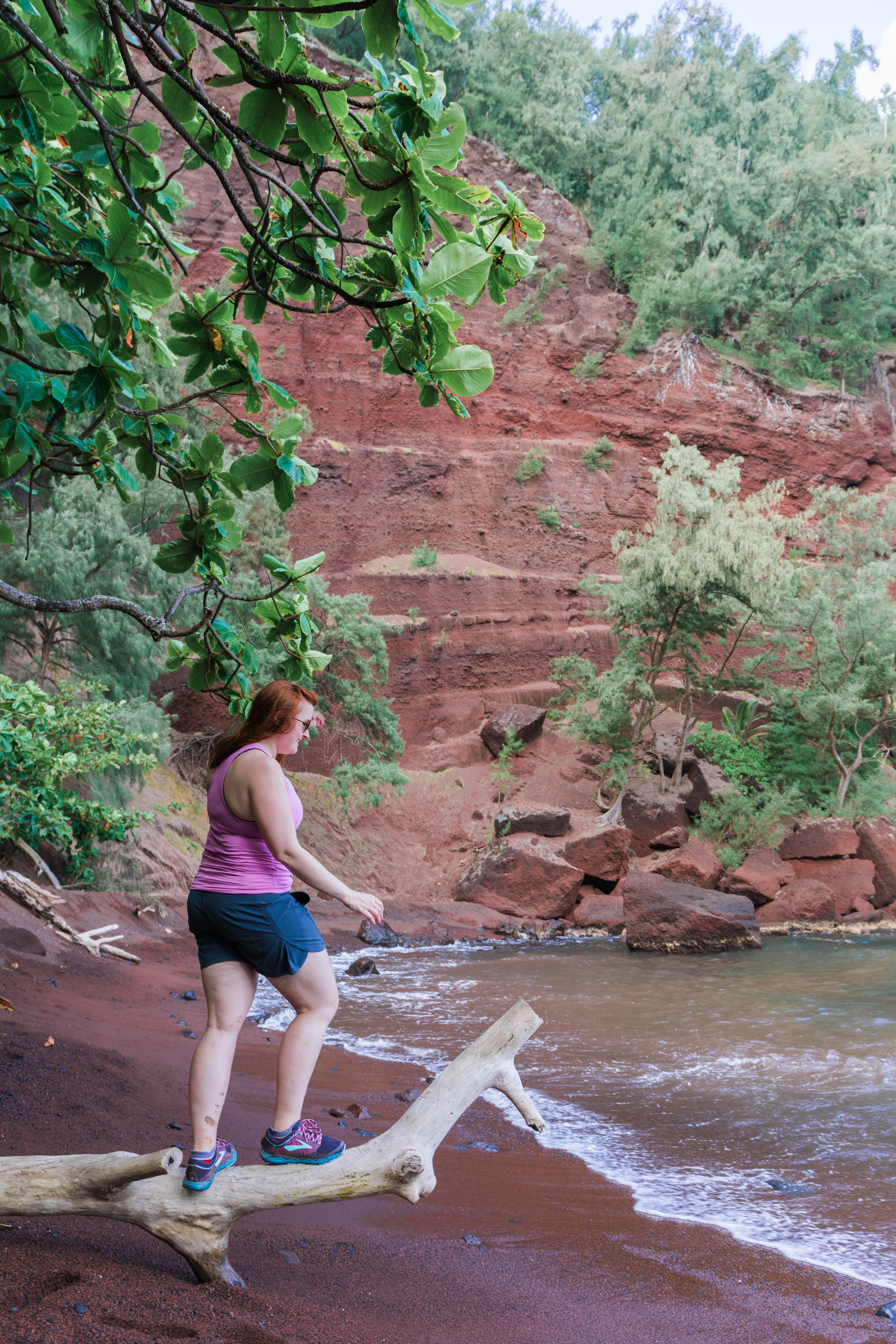
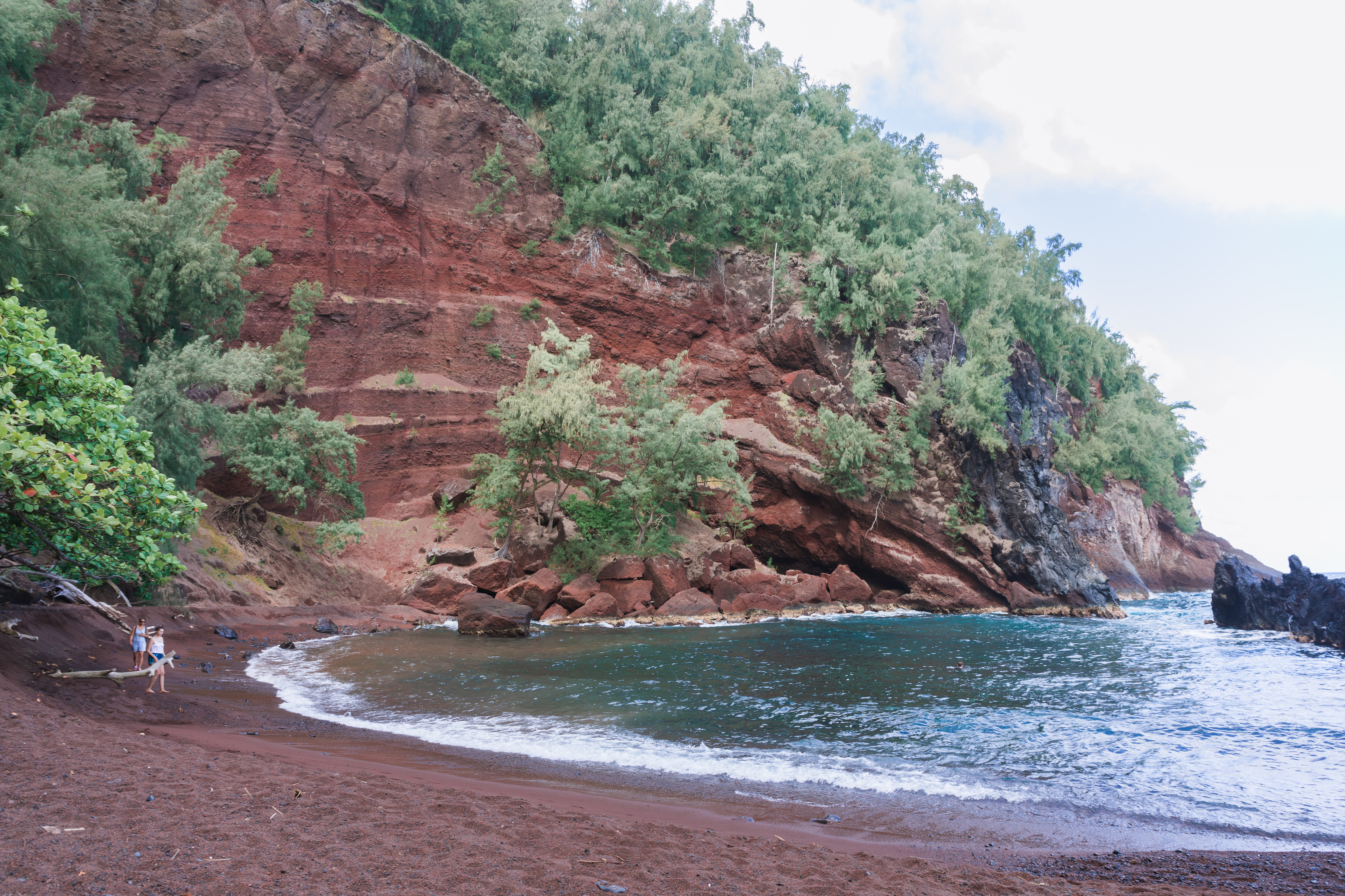
Kaihalulu (Red Sand) Beach
A quick head’s up – the red sand beach is clothing optional. Parking for this hike can be very difficult – mind the signs warning of no parking. If worse comes to worst, there’s a park down the road with a parking lot. Once you’re out of your car, head down the road and watch for a diagonal trail across the field on your left side, just before the closed gate. The trail is a bit steep and falling away in places, so proceed with caution. It’s only 20 minutes or so until you actually reach the red sand. We only encountered one nude sun-bather while we were there. The extra nice thing about the beach is that it is a protected bay, so most of the waves are very calm.
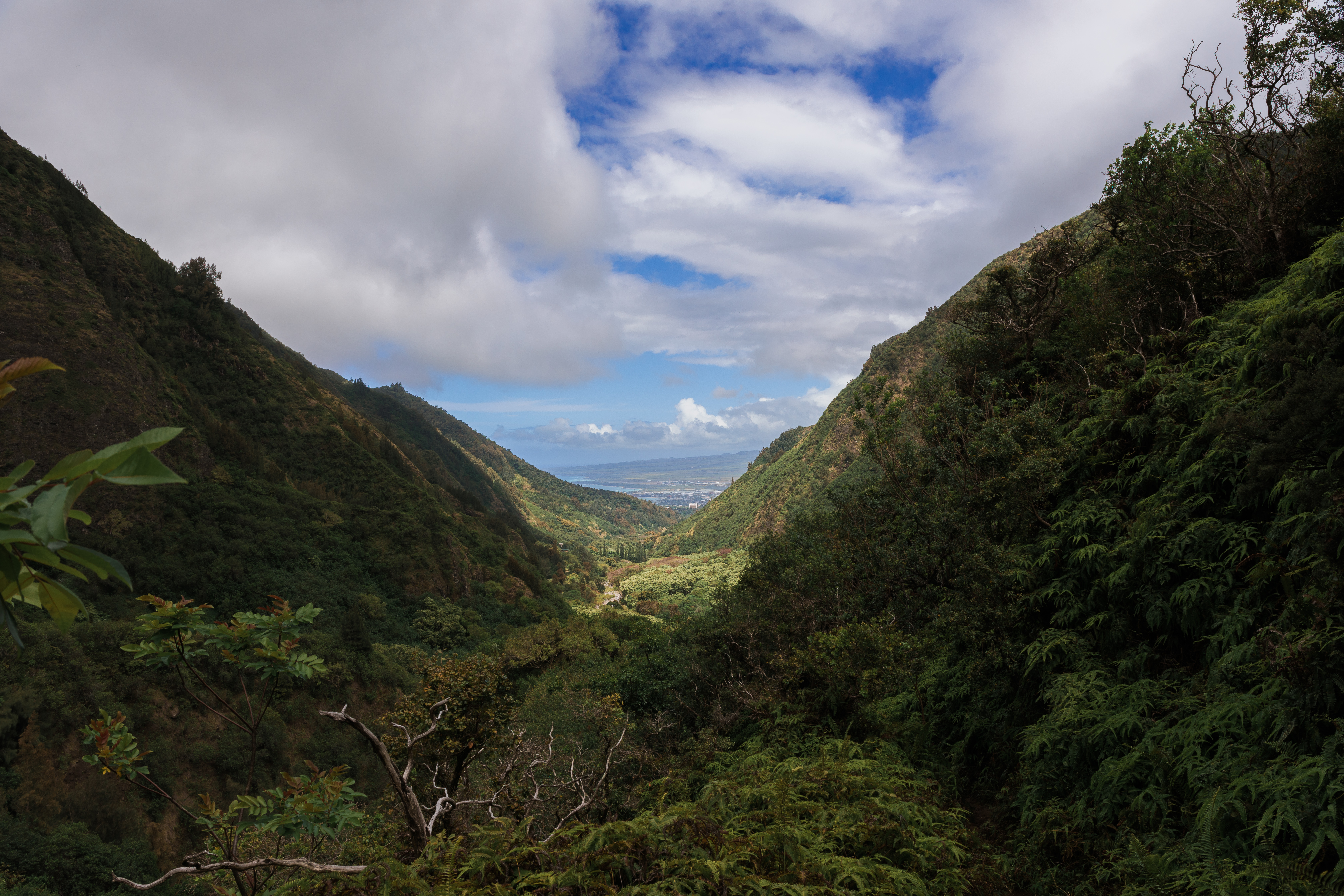
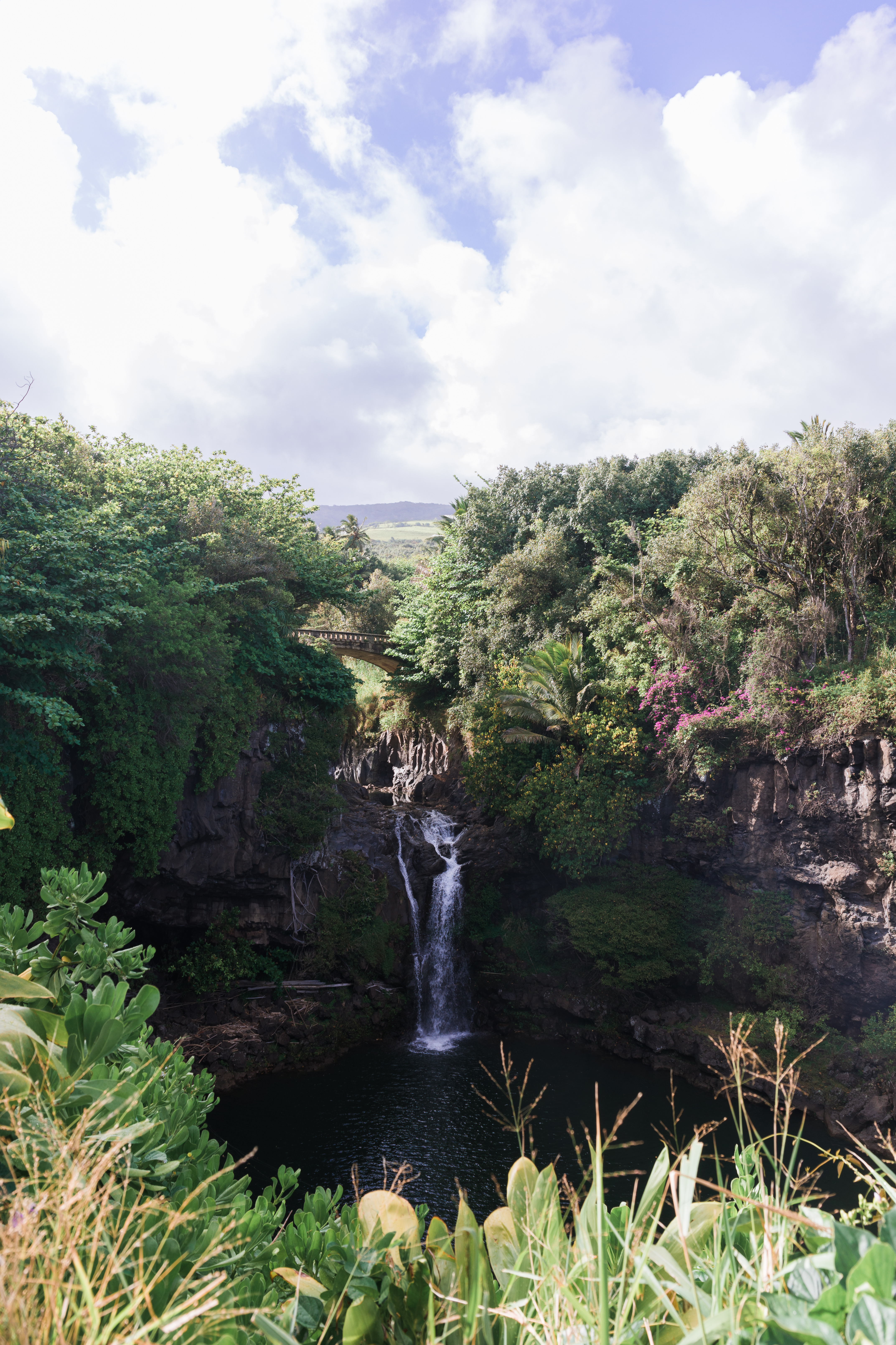
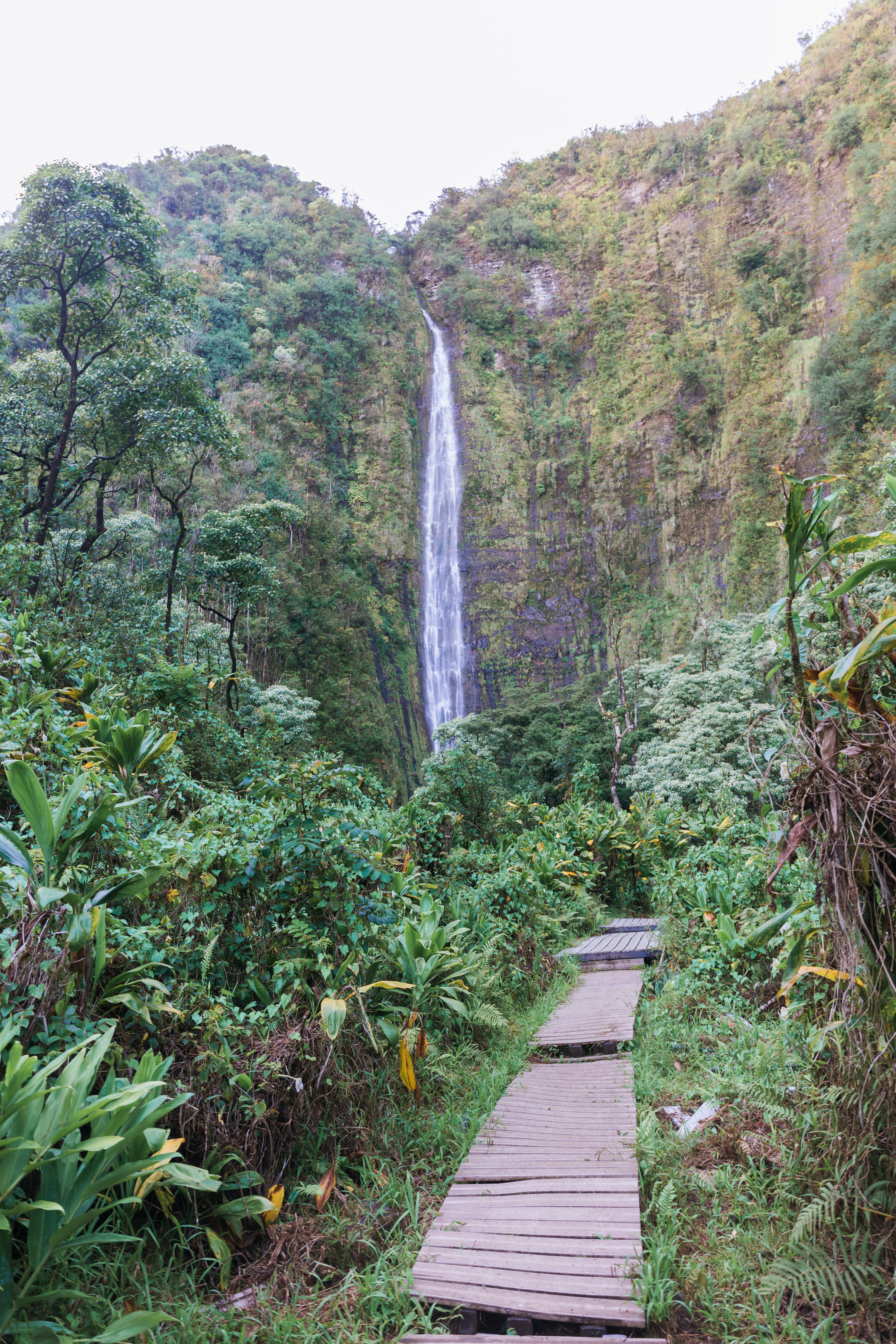
Seven Sacred Pools / Pipiwai Trail
Once you reach the end of the Hana Highway, turn into the Kipahulu Visitor Center. (Technically, the highway keeps going all the way around the south side of the island, but most people turn around here.) The Seven Sacred Pools are no longer open for swimming, but it’s still good for a brief walk. Then head up hill on the Pipiwai Trail. This trail feels a lot different than the rest of the trails on the island. You’ll pass under a giant banyan tree and wander through bamboo forests that are so dark you’ll think the sun has set. But at the end, you’ll be rewarded with a beautiful, towering waterfall.
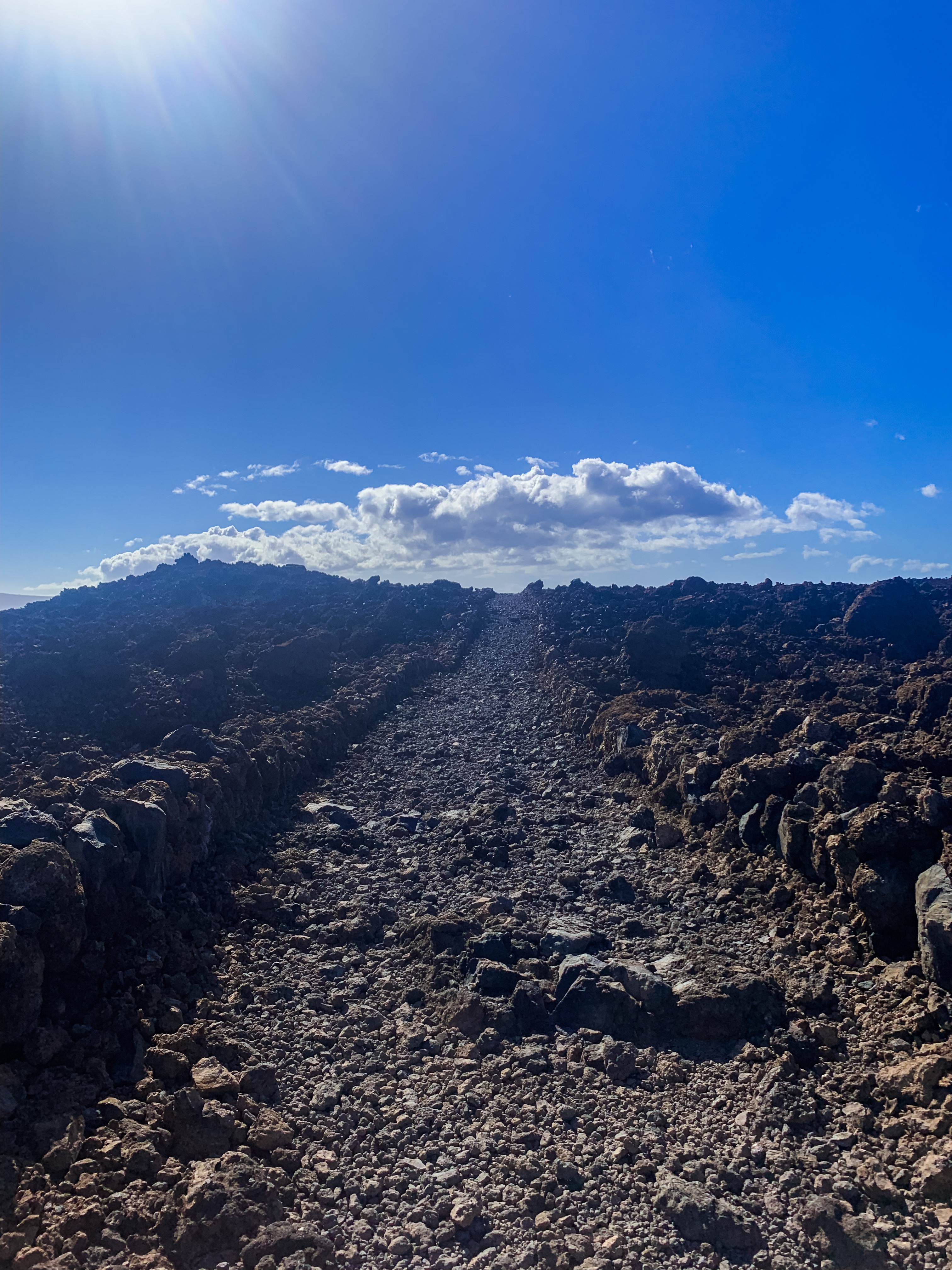
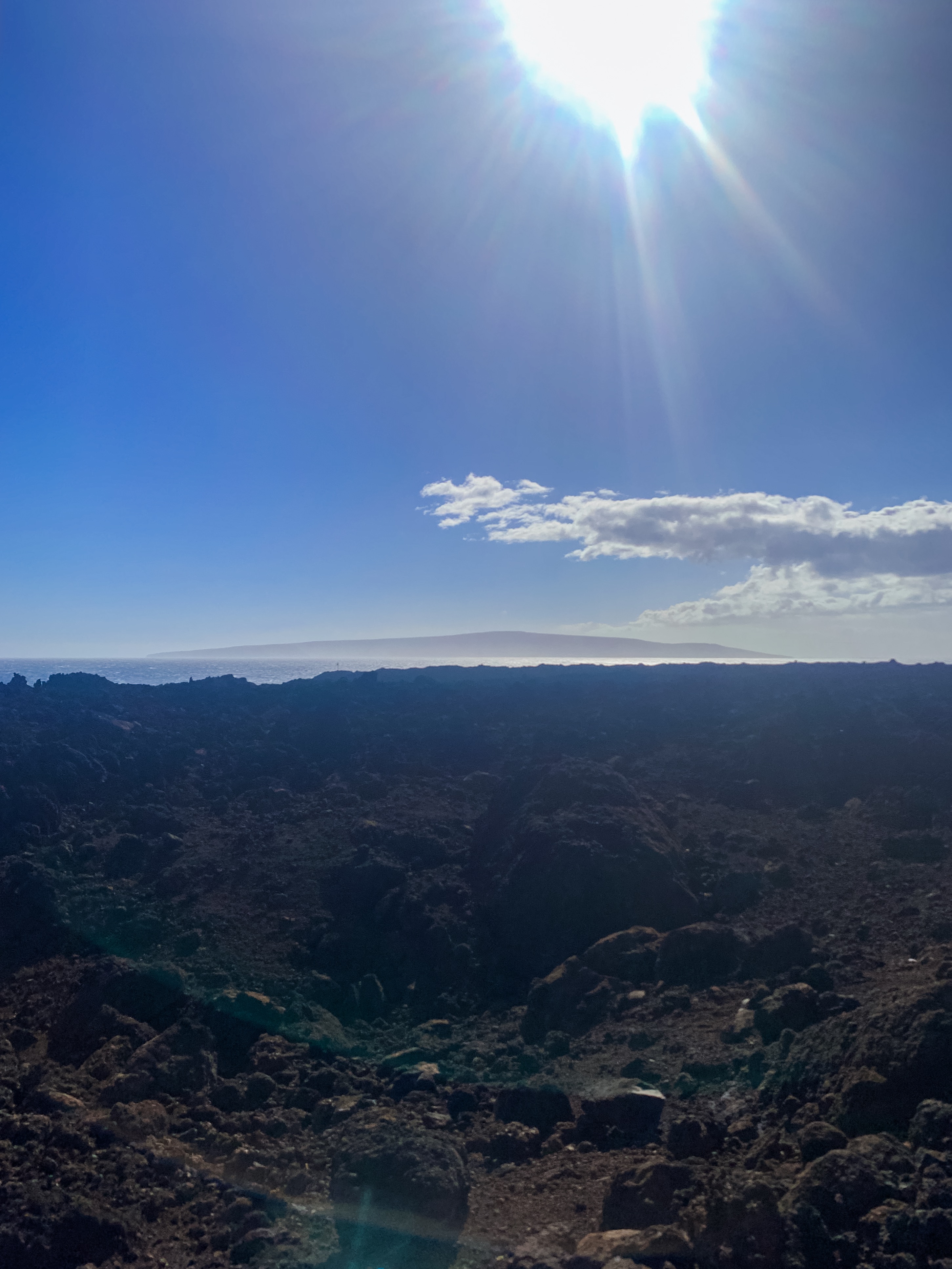
Hoapili Trail (King’s Highway)
Even though it isn’t far from the southern end of the Hana Highway, you’ll have to drive all the way back up to Kihei and then all the way down “South Maui” past Wailea. At the end of the road, you’ll find a parking lot. Jump out, slather on lots of sunscreen, then start hiking. It’s a lot of hiking on lava rock, but the route has been made relatively flat by the previous kings of Maui. If you make it all the way out to the far side, there’s a beach with a short swing and a few Hawaiian ruins. Watch for “wild” goats along the way.
Keonehe’ehe’e (Sliding Sands) Trail
After you enjoy the sunrise at Haleakala, park back at the visitor center and then follow the trail down into the crater. Watch the weather though – we didn’t get to actually do this trail because the entire crater was filled with clouds and they were forecasting terrible weather during our entire visit. We weren’t too upset, since it sounds like the landscape was similar to the Big Island. Nonetheless, it does sound incredible, especially if you have never walked on a former volcano before.
Click the star next to “Maui Hikes by AllThingsKate” to save these hikes to Google Maps on your mobile device


Wow! You did a lot of hiking! We really like I`ao Valley, especially with littles.
We love to hike on vacations so we’re always very active! We’re definitely not lay-on-the-beach people 😉